The single component which makes Google's self-driving cars work

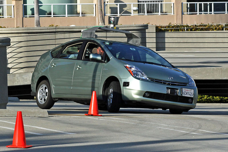
The concept of a self-driving car may still be bordering on science fiction, but Google's recent experiments show that autonomous vehicles have the potential to become a common sight on our roads in the future.
How can a vehicle operate autonomously, change lanes correctly, obey traffic lights and monitor potential hazards including pedestrians and cyclists? It all comes down to a single system which frees up the car to monitor real-time situations: its virtual map.
Through the creation of a virtual map which allows a car to "see" where it is going -- as well as the position of lanes and traffic lights -- a Google self-driving car isn't forced to process full scenes from scratch. The car isn't seeing what we see on Google Maps; instead, the physical world is made digital with precise details including the angles and heights of curbs, intersections measured in inches and how high traffic signals are off the ground.
Google's autonomous cars use such a mapped track in Mountain View, California, where tests are currently taking place. The virtual world is pre-loaded, allowing the vehicle to focus purely on the situation at hand. A Google engineer working on the project said:
"Rather than having to figure out what the world looks like and what it means from scratch every time we turn on the software, we tell it what the world is expected to look like when it is empty. And then the job of the software is to figure out how the world is different from that expectation. This makes the problem a lot simpler."
While Google has mapped 2,000 miles of road in this way, the U.S. alone has something close to four million miles of road. If the project is going to be taken outside of California, there's a lot of mapping left to do. At least the tech giant has an enormous amount of data at its fingertips through Google Maps, satellites and Street View.
Read on: The New York Times
Related:
- Could driverless cars render public transit obsolete?
- Volvo plays with magnets for autonomous cars
- A pipe dream? Analyst says we'll all be driven by our cars by 2026
- In Sweden, 100 driverless cars to take to the streets
This post was originally published on Smartplanet.com